Santa Barbara, CA
L 46°
7mph
2:59 pm
Boating, Fishing, and Travel Information for Santa Barbara, CA
Santa Barbara lies on a section of south-facing coast and is backed up against the Santa Ynez Mountains. Located off the coast of the city are is the Channel Islands National Park. The city gets nicknamed the “American Riviera” due to its sandy beaches, parks, and resorts. Santa Barbara Harbor offers a range of activities for boaters and tourists alike.
-
Monthly Tide Chart
In Santa Barbara, CA -
Weather
In Santa Barbara, CA -
Maps & Charts
In Santa Barbara, CA
Boating in Santa Barbara, CA Map View
Santa Barbara Harbor is administered by the City of Santa Barbara Water Front Department and is under the control of a harbormaster. who has an office at the SW corner of the harbor. Transients should report to the harbormaster for guest slip assignments. The office monitors VHF-FM channel 16, and can be reached by telephone 805-564-5530.
The City Pier, inside the harbor, has diesel fuel, gasoline, commercial ice, water, and other marine supplies and has a hoist with a maximum lift of 2 tons.
There is a boatyard on the SW side of the basin that can handle craft up to 25 tons and 50 feet for hull and engine repairs. A small floating drydock in the harbor can lift craft up to 20 tons for hull maintenance and repair. There are several other boat builders and repair yards in the city of Santa Barbara.
Navigation:
Click the “Map View” button above to see a chart of this harbor.
Santa Barbara, 29 miles NW of Point Hueneme, is a resort city and popular yachting harbor. The harbor is used mostly by pleasure craft and fishing vessels. There are about 1,200 slips in the harbor.
Santa Barbara Light (34°23’47″N., 119°43’21″W.), 142 feet above the water, is shown from a 24-foot white tower about 2 miles W of the harbor entrance. Lavigia Hill, 0.6 mile NE of the light is 459 feet high and the distinguishing feature in approaching Santa Barbara from the E or W.
Submerged shellfish structures are about 0.7 mile SE of Santa Barbara Light in about 34°23’15″N., 119°42’45″W.
Santa Barbara Point, 1 mile E of the light, is a high cliff at the SE limit of the narrow tableland extending from Lavigia Hill. The point is the beginning of a sand beach extending 0.6 mile E to Point Castillo, the W point of the breakwater forming Santa Barbara Harbor.
The harbor has a 500-yard breakwater extending NE from Point Castillo to an extensive sandbar which forms the S side of the harbor. A jetty extends across the sandbar about 400 yards N from the NE end of the breakwater. A light is at the end of the jetty and a light and sound signal mark the connection between the breakwater and jetty. The sound signal is activated by the Santa Barbara Harbor Patrol. The NE side of the harbor is formed by Stearns Wharf; the wharf is marked by a light at the S end. A groin, about 125 yards long, extends S from shore about 0.3 mile W of Stearns Wharf.
A dredged entrance channel leads NW between the breakwater and Stearns Wharf then turns SW into the harbor. The channel is marked by buoys. The harbor buoys are not charted because their positions are frequently changed. The entrance and harbor are subject to rapid shoaling. The harbormaster advises that the entrance channel has a tendency to shoal after SE storms.
SPONSORED CONTENT
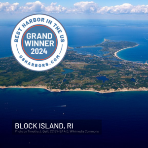
2024's "Best Harbor" Contest Winners Announced
You Voted, and We Have a Clear Winner! Grand Winner, Best Harbor in the U.S. for 2024: Block Island, RI Top 10 Results: Block Island, RI (also 2024’s Northeast regional winner; first time on winners list) Destin, FL (also 2024’s Gulf Coast regional winner; first time on winners list) Padanaram,… Learn More
Fishing in Santa Barbara, CA Map View
For the latest fishing news for California, click here.
Coastal News Updates See All
Deep Learning on the Rocky Shore
4/25/2025
By tula.org. Drones allow researchers to do marine surveys from the sky. Now artificial intelligence is offering a quantum leap in image processing. What are your respective backgrounds in working with these kinds of AI processes? Taylor: I did my master’s degree at Ontario’s University of Waterloo on computer vision systems… SEE MORE
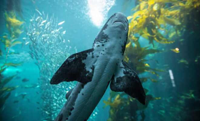
How Sharks Keep the Ocean Healthy
4/23/2025
By Claire Mullin. Sharks have long been portrayed as terrifying predators of the deep, but really, they are essential guardians of the ocean. Despite their fearsome reputation, these apex predators play a crucial role in maintaining the delicate balance of marine ecosystems. Sharks contribute in ways that might surprise you,… SEE MORE

Five Historically Huge Solar Events
4/21/2025
By noaa.gov. Space weather impacts numerous facets of everyday life, including power grids, communications, airline operations, global positioning systems (GPS), and satellites. In addition, there are a large variety of phenomena that are driven by the variability of the sun over periods ranging from hours to years. Solar flares are… SEE MORE
Photo Credits
By Thomas Camargo, CC BY 3.0, https://commons.wikimedia.org/w/index.php?curid=53101170
Reach over 12 million boaters and people who love the coast:
Contact our sales team for an advertising quote.